Innovate for Impact -
Pioneering a Greener Earth Today
Smart Forests, Where
Technology Meets Conservation
Nature's Harmony:
Save It, Sustain It
Tech-Driven Resilience:
Building a Climate-Ready Future

FOREST
Techno Essence Solutions (TES) has extensive proven experience in developing and executing projects centered around Nature-based Solutions (NBS) with a sustainability focus. This enables us to provide an integrated interactive platform for large-scale ecosystem conservation, forest restoration, and climate action initiatives backed by intelligent database.
Our domain knowledge is enhanced by value-added custom database supported by cutting-edge technologies like Remote Sensing, Geospatial, LIDAR, IoT, AI/ML, Location Intelligence and Data Analytics, supported by deep sectoral expertise.
Related Services: Nature based solutions EnviroIMXTM
Focus Areas

Policy Review and Advisory
We evaluate and advise on forest policies, legal frameworks, and governance to ensure alignment with environmental goals and global best practices. We recommend strategies to address challenges like climate change, deforestation, and biodiversity loss, while reviewing policy alignment with global commitments such as SDGs, Paris Agreement, NDCs, and REDD+ initiatives.

Forest Landscape Restoration
Forest Landscape Restoration (FLR) is a global effort to restore degraded and deforested lands, helping to recover ecological integrity while also improving human well-being. It seeks to restore essential ecosystem services like soil fertility, water regulation, and biodiversity, while promoting sustainable land use practices. We specialize in offering cutting-edge solutions to restore degraded ecosystems and enhance forest health.
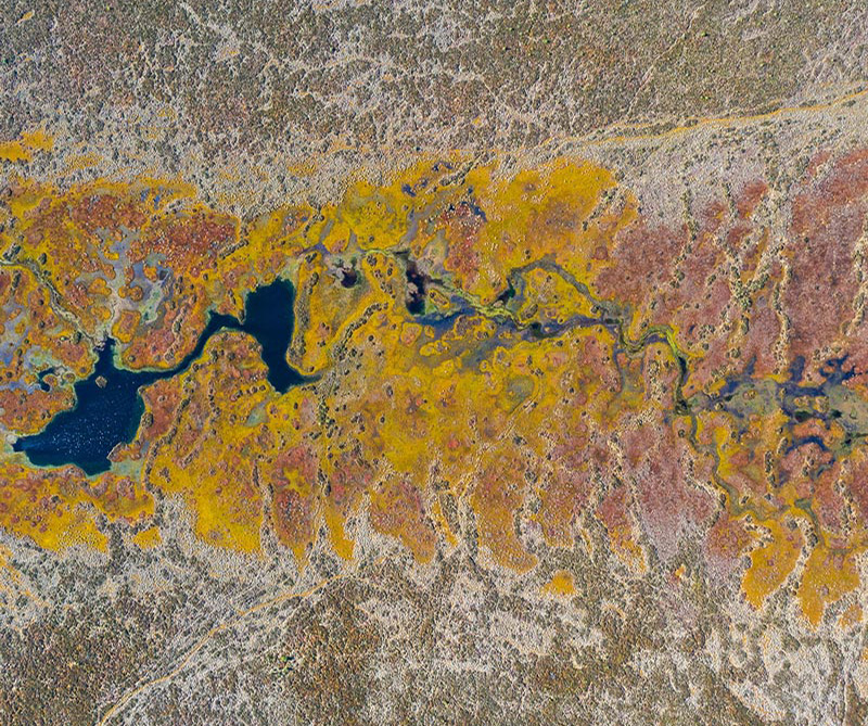
Forest Mapping and Characterization
Forest type map categorizes forests based on vegetation, tree species, climate, soil, and ecological zones, such as tropical rainforests or boreal forests. These maps support land use planning, biodiversity conservation, resource management, and environmental monitoring. Phenology characterization helps understand climate change effects, stratification, predict forest responses to environmental changes, and manage resources more effectively.

Habitat Conservation Management
Habitat Conservation Management aims to protect and restore habitats to preserve biodiversity and ecosystem services. It includes safeguarding critical habitats, managing land use, and promoting sustainable practices to prevent species extinction and habitat degradation. Key activities include Habitat restoration, Species monitoring and Invasive species control. We also develop conservation strategies, conduct habitat connectivity studies, and support policy development for sustainable habitat management, ensuring ecosystems thrive while meeting human needs.
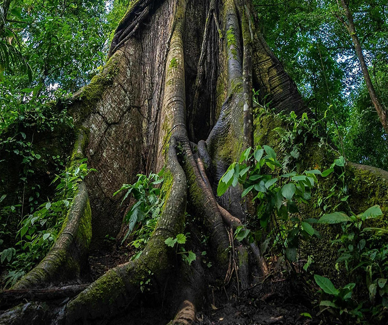
Forest Carbon Stock Assessment
Forest Carbon Stock Assessment quantifies carbon stored in forest biomass, including trees, soil, and vegetation. This is crucial for understanding forests' role in carbon sequestration and climate change mitigation. It involves field measurements, remote sensing, and carbon estimation models for assessing above-ground and below-ground carbon. Our services include Forest inventory surveys, Satellite-based carbon monitoring, GIS mapping to calculate carbon stocks etc. These services support carbon credits, climate policy compliance, and help meet carbon reduction goals while promoting sustainable forest management.

Tree Census and Mapping Outside Forest
Our expertise spans high-resolution satellite imagery, UAV/drones, and LiDAR for precise mapping of tree distribution, canopy cover, and species across urban areas, farmlands, and roadsides. We integrate GIS tools and AI analytics to assess tree density, leaf area index (LAI), health, and biomass, supporting urban greening, agroforestry, and biodiversity conservation. With IoT-enabled sensors and mobile apps, we offer near real-time monitoring in tracking tree health and growth and environmental impact, ensuring timely interventions. Our solutions include LU & LC analysis, predictive modelling, and change detection, promoting ecological balance, sustainability, and climate action through efficient ToF mapping and tree census initiatives.
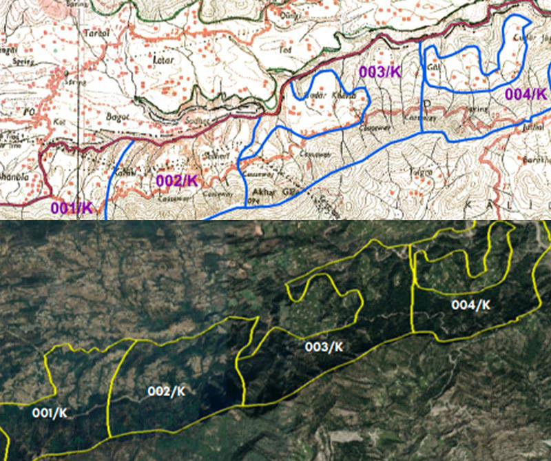
Forest Boundary Database
The forest boundary demarcation at high level spatial accuracy can be achieved using DGPS & ETS, eliminating human errors through integration with SOI CORS networks. We also establish forest boundary monumentation and delineation by overlaying revenue cadastral maps with high-resolution satellite imagery. The forest boundary database is a classified, restricted collection of geographic and administrative boundaries for forest areas. It includes detailed information on Reserved Forests (RF), Protected Forests (PF), National Parks (NP), Wildlife Sanctuaries (WLS), IUCN migratory bird routes, and ecological sensitive areas, with boundary details, coordinates, and descriptions of conservation aspects and species' ecological importance. This database can be made available integrating web portal framework for monitoring and decision-making purpose.
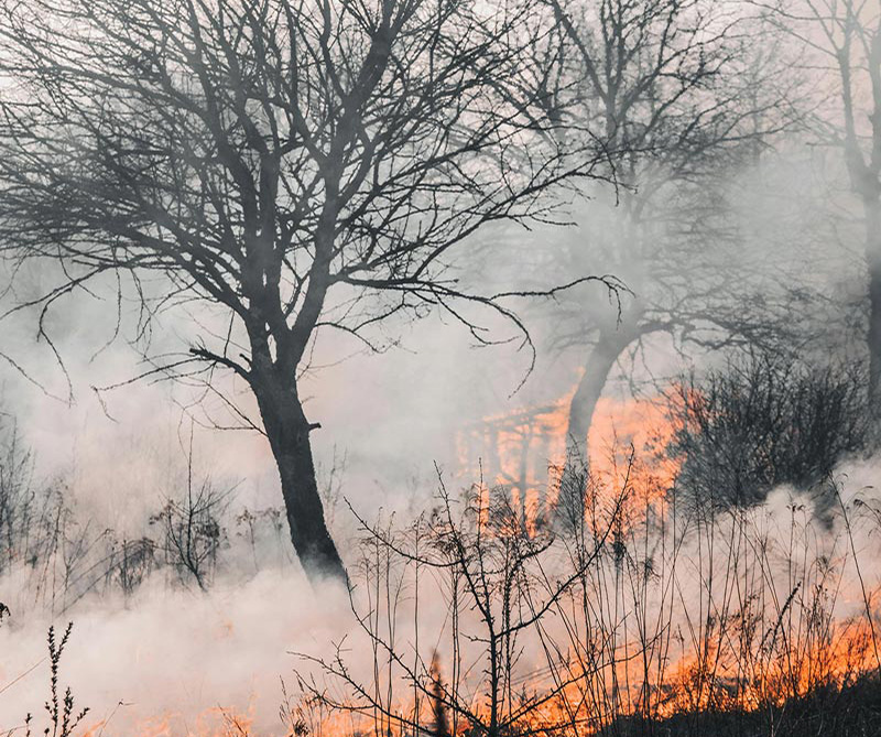
Forest Fire Management
Forest fires are a common threat in forest environments. Key steps for prevention and control using technological solutions which includes high-resolution satellite imagery, drones technology, remote sensing to analyse different indices, and model simulations.
- Identification and Mapping of fire-prone areas.
- Forest fire forecasting technology using edaphic and biotic parameters including anthropogenic actions.
- Preventative measures through technology and forest management plans.
- Near real-time monitoring and time series analysis of fire-prone areas.
- Communication networks to ensure timely forest fire information, manpower and material to fire sites.
- Regular training for forest staff and fire protection committees.


